
Songnae Bridge (Jukjang-myeon) CCTV live camera guide
Service updated:
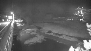
A view of the water flow around Songnae Bridge as you pass along the mountain roads of Jukjang-myeon, with the rain forecast. Water in the mountains changes quickly in rain, so check road closures in Pohang City notices.
Where can I view this camera?
Use the link below to open the original CCTV view provided by Pohang City.
View official camera ↗What kind of camera is the Songnae Bridge CCTV in Jukjang-myeon?
This disaster-monitoring camera, run by the Pohang City Disaster and Safety Countermeasures Headquarters, watches Songnae Bridge in the Ibam-ri area of Jukjang-myeon, Pohang.
If you plan to pass along the mountain roads of Jukjang-myeon, you can use it as a reference in advance when rain is forecast. Water in the mountains changes quickly in rain, so check road closures in Pohang City notices and weather warnings, and do not decide from the view alone.
Good times to check it
- When you are passing along the mountain roads of Jukjang-myeon
If you are heading into this area, check before you leave that the original view opens, and look at the rain forecast too.
- When heavy rain is forecast in the mountains
Valley water can rise quickly in rain. Avoid pushing on into the area and check Pohang City notices.
Practical information
| Region | North Gyeongsang |
|---|---|
| Provider | Pohang City Disaster and Safety Countermeasures Headquarters |
| Original camera name | 죽장면(송내교) |
| Media type | Live video |
Source: Pohang City Disaster and Safety Countermeasures Headquarters
Hourly weather for this area
Forecast area: North Gyeongsang
Loading hourly weather.
Frequently asked questions
How do I view the Jukjang-myeon (Songnae Bridge) camera?
Select “View official camera” on this page and the camera view in Pohang City’s disaster weather information system opens directly.
Can I tell the water level from the view?
You cannot tell the water level unless the original view shows it. If the rain continues or the water looks to be rising, keep away from the stream, and check notices and warnings first.
Region and sources
- Region
- North Gyeongsang · 경상북도
- Original camera name
- 죽장면(송내교)
- Media type
- CCTV video
- Provider
- 포항시 재난안전대책본부
- Original source ID
- 80020
- Address listed by the source
- 포항시 북구 죽장면 입암리 858-1
The region helps you find the place; the exact installation location has not been verified.
Before using this view
Availability and camera direction may change with the operator’s circumstances. A working link does not mean the video is currently playing. Check the original source for maintenance, delays and whether an image is stored rather than current.
The camera cannot establish whether hiking, swimming or a river visit is permitted. Check the operator’s closure notices and weather alerts together.
Where a preview image is available, it links directly to the operator’s original image without storing or copying it on our server. View video on the official page. The operator’s terms apply on external pages.